Dependable navigation, less data, better battery, storage control.
And safer travel without signal.
How to use offline maps and why it matters
Learning how to use offline maps means saving map areas to your phone so they work without an internet connection.
When service drops in rural roads, subways, mountains, or crowded events, navigation remains available and calm.
Offline tiles, place data, and route logic live on the device, so searches and turn-by-turn guidance keep working.
Phone battery lasts longer because radios do less work fetching tiles and traffic every few seconds.
Roaming costs fall on international trips because you do not rely on constant data.
Safety improves because directions and landmarks stay visible when it matters most.
How to use offline maps: what gets saved and what does not
Downloaded areas store base maps, roads, and many POIs so you can search and route locally.
Live traffic, lane closures, and real-time transit are limited or unavailable offline.
Satellite imagery and Street View usually require data and should not be assumed.
Large areas take space, so size and freshness become part of your trip prep routine.
How to use offline maps on iPhone with Google Maps and Apple Maps
Google Maps on iPhone supports robust offline areas with search and driving directions.
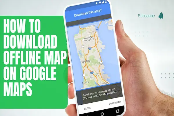
Open Google Maps, search a city or region, tap Download in the card, and pinch to set the exact area.
Give the map a clear name like “Utah National Parks Sep,” then connect to Wi-Fi to save space and time.
Apple Maps now supports limited offline regions for iOS 17+, including driving directions and place details.
Open Apple Maps, search a place, tap Download, choose the coverage box, and allow Auto-Update on Wi-Fi.
Keep both apps if your trip mixes cities and remote parks so you have two engines ready to route.
Quick setup tips that save stress
Download maps while on stable Wi-Fi and charging so tiles complete without interruption.
Toggle Low Power Mode during travel to stretch battery without losing navigation.
Move your downloaded areas higher in the list and delete old ones to avoid confusion on the road.
How to use offline maps on Android with Google Maps
Google Maps on Android offers full offline areas with address search and spoken turn-by-turn.
Search a destination, open its card, tap Download, and adjust the rectangle to cover your whole drive.
Open Settings → Offline maps to enable Auto-update and Download on Wi-Fi only for freshness and data control.
If storage is tight, set the download location to SD card when supported by your device.
Pair offline maps with Battery Saver and Airplane Mode + Wi-Fi when stationary to preserve power.
Keep an extra region that overlaps borders so routing continues if you stray off your primary area.
How to use offline maps on Android: small habits with big payoff
Name regions by state or trip segment so troubleshooting is obvious mid-drive.
Update the day before departure so closures and POIs are as current as possible.
Test one local offline route before travel to confirm voice guidance and re-route behavior.
How to use offline maps for navigation, search, and routing
Driving directions generally work offline between points inside your downloaded area.
Re-routing also works when you miss a turn, provided the alternate path stays within the saved box.
Searching common categories like gas, food, and lodging works with cached POIs.
Long cross-country trips require multiple overlapping regions that follow your corridor.
Transit guidance usually needs data, so save backup walking routes between key stations.
For complex hikes, save trailhead regions and carry a dedicated GPX in a hiking app as a backup.
Getting addresses and pins ready
Star or favorite your hotel, trailhead, and fuel stops so they appear even when search is flaky.
Save custom pins labeled with mile markers or gate codes so you are not typing in the rain.
Keep a tiny notes doc with reservation numbers and check-in instructions in case pages will not load.
How to use offline maps: storage, updates, and space management
Offline regions can range from a few hundred MB to multiple GB depending on density and size.
Turn on Auto-update over Wi-Fi so the app refreshes areas without manual work.
Delete finished trips every month to reclaim space and keep only current regions.
If the phone is tight on storage, prefer several small regions rather than a single huge state tile.
Move downloads to SD card where supported to keep internal storage free for photos.
Schedule a pre-trip “map refresh” task alongside packing and boarding passes.
Naming, organizing, and auditing
Use a clear naming pattern like “2025-06 Italy North,” “2025-06 Dolomites Hikes,” and “Return Route.”
Sort the list by Recently updated so stale tiles are obvious.
Run a quick audit monthly so the device does not carry dead regions you will never revisit.
Accuracy and workarounds
Base roads and addresses are reliable, but construction zones and new streets may lag until updates download.
Speed limits, camera alerts, and lane guidance can be limited offline, so drive defensively in unfamiliar areas.
Traffic-aware ETAs are not available without data, so share a conservative arrival estimate.
If a detour pushes you outside the region, pull over and expand the area when a signal returns.
For rural fuel planning, phone ahead or check recent reviews while you still have reception.
Carry a paper overview map as a redundancy when cell coverage is severely limited.
How to use offline maps: mixing online and offline smartly
When service returns, toggle data briefly to fetch traffic and confirm closures, then go offline again.
Download small “city cores” for heavy data areas so tiles load instantly while data handles live info.
If you use CarPlay or Android Auto, confirm it supports offline guidance for your specific app and version.
Battery, GPS, and performance
GPS itself does not require data, but constant tile downloads do, so offline saves power.
Dim the screen, use dark mode, and keep the phone on a vent mount to reduce heat and throttling.
Plug into a reliable charger rated for your phone so voice guidance never dies mid-route.
Disable background apps that compete for GPS and location when navigating for hours.
Let the map cache settle for a few seconds after launch before starting a drive.
Keep a power bank ready for trailheads and rental cars with weak USB ports.
How to use offline maps: airplane mode, roaming, and cost control
In low-signal areas, airplane mode with GPS on can stabilize performance and prevent radio hunting.
Roaming travelers save money by relying on offline tiles and brief Wi-Fi stops for updates.
Download language packs for voice prompts if you prefer native-language guidance while abroad.
Safety, privacy, and sharing
Offline maps reduce the need to pull over and hunt for service in risky places.
Share a live location only when you regain data and want someone to follow progress.
Clear search history and old locations periodically if you share the device with family.
Store emergency numbers and offline medical or roadside contacts in your notes.
If traveling in pairs, both phones should carry the same offline regions for redundancy.
Avoid publishing exact trailhead pins publicly if they reveal sensitive or private locations.
How to use offline maps: sending locations and waypoints ahead of time
Before a trip, text critical pins to your party while everyone has Wi-Fi.
Export starred places as a list so a companion can import the same waypoints.
Print a one-page fallback with a QR that opens your hotel pin for drivers who prefer their own app.
Common mistakes and quick fixes
Forgetting to download the return route causes stress, so save both directions ahead of time.
Saving only a city tile fails on scenic detours, so include countryside corridors.
Letting auto-update stay off ages your data, so enable Wi-Fi refresh in settings.
Downloading on mobile data mid-trip wastes bandwidth, so use hotel or café Wi-Fi.
Saving a tiny box around one attraction breaks routing, so include the highway and alternates.
Ignoring storage warnings cancels downloads, so free space before the big tiles start.
Skipping an overlap buffer creates dead zones, so extend each region 30–60 miles past the edges.
Trusting offline without a test invites surprises, so run a local route in airplane mode before departure.
Relying on live transit offline causes delays, so pre-plan walking links between key stations.
Expecting satellite view offline disappoints, so use standard maps and star landmarks instead.
Vague region names confuse mid-drive, so label areas by trip segment and date for quick recall.
Filling internal storage with tiles blocks photos, so move downloads to SD card when supported.
Missing voice packs mutes guidance, so download offline voices and set volume/Bluetooth output.
Extreme battery savers kill GPS updates, so whitelist the maps app and keep screen dim instead.
A drifting compass misguides turns, so recalibrate and enable high-accuracy location before driving.
CarPlay/Android Auto may vary offline, so verify guidance works without data in your setup.
Outdated app engines misroute, so update the maps app and language/region data pre-trip.
How to use offline maps: quick troubleshooting on the road
If addresses will not resolve, navigate by dropped pin or saved favorite.
If the app crashes, relaunch, toggle GPS, and reopen a smaller nearby region.
If voice guidance is silent, check phone volume, focus mode, and Bluetooth output in the car.
Conclusion and next steps
Choose your app and download key regions on Wi-Fi while the phone is charging.
Star hotels, trailheads, fuel, and critical stops so they are one tap away offline.
Enable auto-updates, name regions clearly, and remove stale tiles to save space.
Pack a car charger and a power bank so guidance stays steady on long routes.
Run a local test route tonight so “how to use offline maps” feels effortless before your trip.
Overlap adjacent regions by 30–60 miles so re-routes work even when you miss a turn.
Set spoken directions to your preferred voice and volume, then verify Bluetooth output in the car.
Move downloads to SD card (when available) to preserve internal storage for photos and videos.
Add a short notes file with reservation codes, gate combos, and emergency numbers for zero-signal moments.
Print a one-page fallback map or screenshot key areas in case the phone fails or overheats.
Share pins and regions with a travel partner so both phones can navigate if one loses power.
Refresh all offline areas the day before departure to capture the newest roads and POIs.